CSM 3D VIS™
Your ultimate 3D conceptual Site model builder
Please visit our YouTube channel for details and an online demonstration
The ultimate solution to the creation of your 3D CSMs
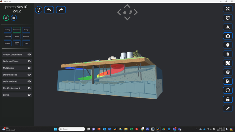
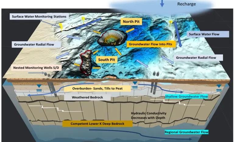
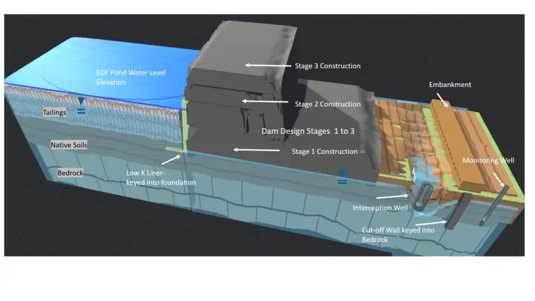
Imagine a software solution that finally allows the site professions to create immersive, fully rotating 3D CSMs. We are excited to announce the launch of CSM 3D Vis™, the new innovative and affordable 3D Conceptual Site Model (CSM) software program focusing on contaminated sites, mining sites and natural environments. Welcome to your very own 3D CSM builder- a powerful visual aid, data evaluation and communication tool to help share your technical information and tell your story!
As we know, Conceptual Site Models are integral to the evaluation and presentation of contaminated site impacts, remedial/action planning, mine site layouts and permitting, Environmental Impact Statements (EIS) and Environmental Impact Assessment (EA) reporting. In fact, many regulators and clients require robust CSM as part of regulatory submissions, EISs, EAs and stakeholder engagements.
Until now, there were significant technical gaps in developing 3D CSMs in the environmental and mining space. CSM 3D Vis™ was specifically created to save time and resources while creating immersive 3D CSMs. Traditional methods involve a cumbersome process. Limited capabilities and the risk of tying up valuable resource either developing simple 2 static model or complex, expensive time reliant numerical models with a steep learning curve. This is where our innovative software steps in to solve this issue and transform your modelling approach. The site professionals can now create robust 3D CSMs and not be constrained with back-and-forth design team/graphic design edits thus saving time and resources by having the site professionals leading and creating the models. CSM 3D Vis™ is a cost effective, and solution driven software, with an easy-to-use layout and designed with the entry to seasoned professional in mind.
CSM 3D Vis™ offers an unparalleled solution for creating immersive and accurate representations of sites, transforming the way professionals visualize, communicate and plan projects. CSM 3D Vis™ enhances your collaboration and sharing capabilities, allowing you to present your ideas and concepts with your team on-line, with clients, and as part of your reports or presentations.
Elevate your projects, unleash your creative potential and visualize your ideas with stunning detail!
The value of CSM 3D Vis™ in your tool box
- Innovative: Stay ahead with state-of-the-art technology tailored to the mining and environmental sectors.
- Efficiency: save time and resources with intuitive tools, designed to streamline workflows.
- Accuracy: Tell your story and help make informed decisions backed by your data and realistic visualizations.
- Cost Effective: Low cost with monthly or yearly subscriptions.
- Fully supported: Our team of professionals are here to help with any of your needs to get you going.
- Easy to Use: CSM 3D Vis™ prioritizes user accessibility without compromising the sophistication of its features. It empowers users of all skill level to harness advanced technology effectively making complex site modelling tasks manageable and productive.
CSM 3D Vis™ stands out not only for its advanced capabilities but also for its user-friendly design, ensuring a seamless experience for all users:
- Intuitive Interface: Our software features an intuitive interface designed with the user experience in mind. Navigation is straightforward, making it easy for both beginners and experienced professionals to quickly familiarize themselves with the tools.
- Drop and Drag Functionality: Create complex 3D models with ease, using drop, drag, scale and rotate functionalities for all assets. This intuitive feature allows users to place assets precisely within the model, reducing the learning curve and saving time.
- Guided Workflows: CSM 3D Vis™ includes guided work flows to simplify tasks, integrating site maps, site photos, DEMs and importing your own 3D objectives. Our step-by-step guidance ensures that you achieve your results efficiently.
- Interactive Tutorials and Help: Comprehensive tutorials are available online, our one-on-one training tutorials and our 10-step fast user guide will enhance your understanding and proficiency.
- Customization and Flexibility: Despite the ease of use, CSM 3D Vis™ offers extensive customization options. Users can tailor their models to specific requirements and adjust parameters to explore site specific conditions.
Key Features of CSM 3D Vis™
Are you ready to transform the way you visualized and plan your mining and contaminated sites? CSM 3D Vis™ empowers you to create detailed and highly realistic 3D models for your site with the following features.
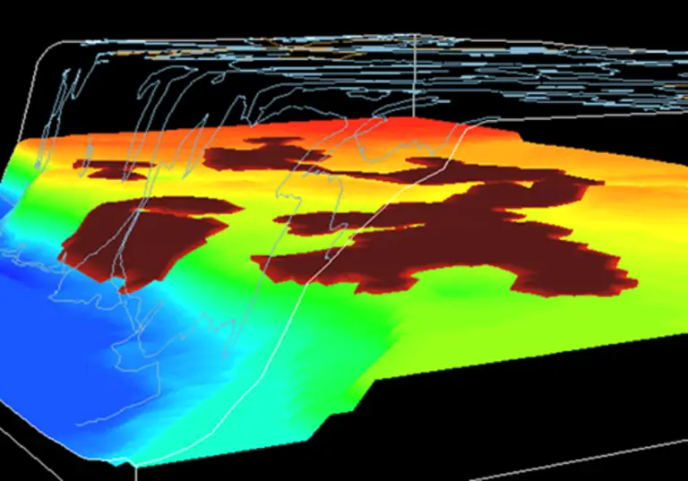
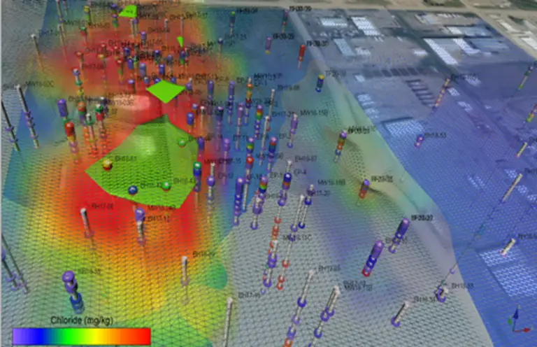
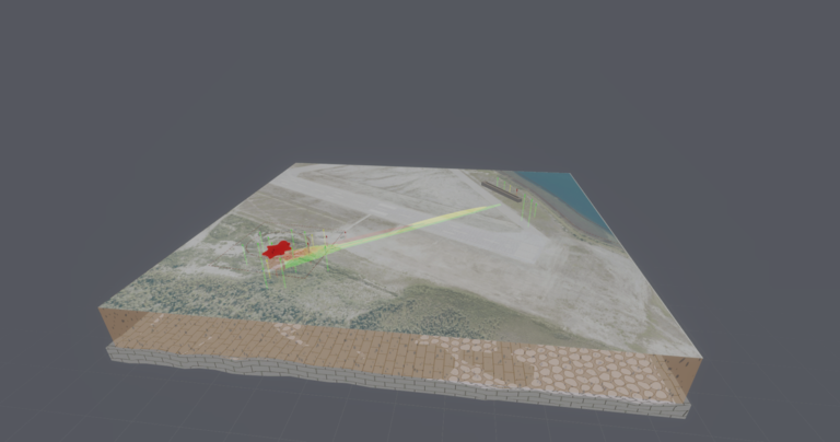
- Integrated Visualization with our GIS Terrain Loader Pro: Seamlessly integrate site topography maps, Digital Elevation Models (DEMs) to create comprehensive and advanced geological, hydrogeological frameworks.
- Import Your 3D Files: We want our software to link up to your outputs. Our software supports the import of 3rd party asset libraries including 3d GLTF/GLB, fbx, obj files from other software. Simply import your files and create your own assets.
- Scenario Planning: Interactive Assets allows all features to be turned on or off with the click of the mouse. Show different scenarios such as mine operations or closure. visualize the impact of various strategies on your site development and plume remediation with simple clicks.
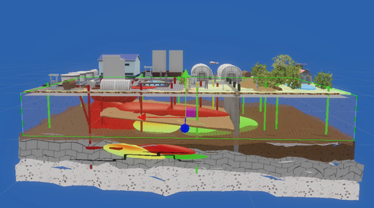
- Advanced 3D Asset Library: Generate detailed and realistic 3D models of contaminated sites and mining sites with a full library of pre-built assets, structures, buildings and contaminant sources.
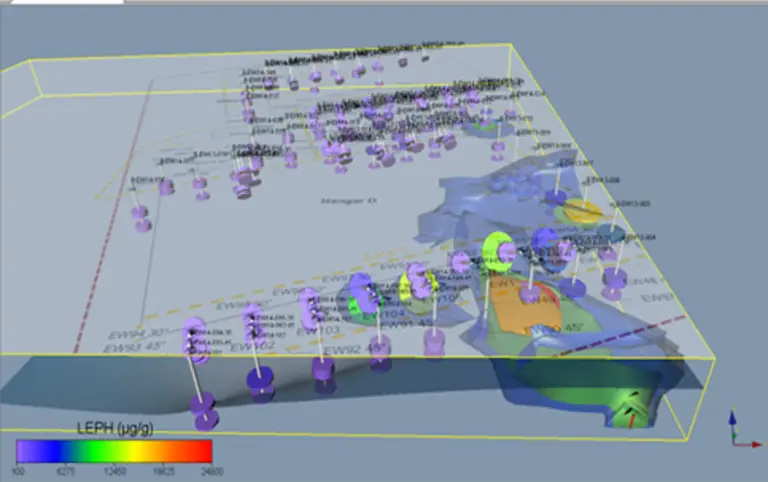
Geological Unit Transparencies: Our model allows the user to change and modify not only the intensity of the surface lighting, but allows the users to change the transparencies of the Geological assets to view into the model domain for a superior and stunning look at 3D plumes or structures.
- Deformation Geology and Groundwater Function: Use our unique deformation function to create hills and valleys, deform and tilt site geological layers, create unique topographic features and unique hydrogeological settings, including water table drawdowns.
- Rotate and Print Screens: The interactive photo system allows a photo image of any angle and perspective, for post processing.
- Add Images and Data Graph: showcase any photos or data graphs for your presentation.


